Profile URL: https://hdl.handle.net/20.500.13091/11662
Job Title:Doç. Dr.
Email Address:eertunc@ktun.edu.tr
Main Affiliation:02.08. Department of Geomatic Engineering
Status: Current Staff
ORCID: 0000-0002-6982-0459
Scopus ID: 56038596200
YÖK Akademik: 278B61E895CA6B60
Google Scholar: Ual1pSYAAAAJ
Web of Science ID: GNP-6488-2022
Name Variants:
Ertunç, E. Ertunc, E.
33 results
Scholarly Output Search Results
Now showing 1 - 10 of 33
Article Citation - WoS: 5Citation - Scopus: 1Comparison of Three Different Optimization-Based Land Reallocation Models in Land Consolidation: a Case Study in Aydin/Turkey(PARLAR SCIENTIFIC PUBLICATIONS (P S P), 2019) Ertunç, Ela; Çay, TayfunLand consolidation (LC) is the primary and most effective land management instrument to address land fragmentation problems, which has been applied in many countries around the world. Land consolidation is not just the reallocation of fragmented parcels, it is in an important instrument of rural development in many countries. Land consolidation projects consist of various steps. Land reallocation is crucial and challenging stages with many factors playing a role in it. Thus, the usage of computer technology has been essential for fast and efficient progress in projects. In this case study, three different land reallocation models, Fuzzy Logic (FL) based, Genetic Algorithm (GA) based, and designed Fuzzy Genetic Algorithm (FGA) based land reallocation models, are compared for Land consolidation projects in the reallocation of newly created regular-size parcels to landowners. As a result, the Genetic Algorithm based and Fuzzy Genetic Algorithm based models are more successful than the Fuzzy Logic based model in terms of the average parcel size, the number of parcels, and the average number of parcels per landowner. The benefits derived from both models are much higher compared to conventional models. The proposed models save time and improve the results for future land consolidation projects.Article Assessing the Impact of Land Consolidation on Agricultural Transport-Related Co₂ Emissions(Elsevier Sci Ltd, 2026) Kök, Halime Nur; Ertunç, ElaCarbon emissions are one of the most important drivers of climate change, threatening global sustainability goals. The agricultural sector, which is one of the important sources of greenhouse gas emissions (GHG), deepens this problem with increased fuel consumption and CO2 emissions due to land fragmentation. When fragmented lands are transformed into large and holistic agricultural areas thanks to land consolidation (LC), tractor operations can be carried out more regularly and this can reduce fuel consumption. This study examines the impacts on transport-related CO2 emissions and fuel consumption in three different land consolidation areas (Akçaşar, Borukuyu and Yenikuyu). Transportation distances before and after land consolidation were analysed and linked to tractor fuel consumption; transport-related CO2 emissions were estimated based on these data. In the calculations, the Tier 1 method was applied based on the guide published by the Intergovernmental Panel on Climate Change (IPCC). The study also tested whether the differences in distance achieved in the before and after LC periods were statistically significant. The results show that the number of parcels decreased and transportation distances were significantly reduced after land consolidation. Accordingly, fuel consumption and transport-related CO2 emissions decreased by 32% in Akçaşar, 25% in Borukuyu, and 30% in Yenikuyu, respectively. Paired sample t-test and Wilcoxon analyses confirmed that these differences were statistically significant (p < 0.001), while Cohen's d values indicated a moderate effect size. These findings demonstrate that land consolidation can significantly reduce transport-related emissions by improving the efficiency of agricultural transportation processes and can contribute to sustainable agriculture and climate change adaptation policies.Article Arazi Toplulaştırma Projelerinde Parsel Şekil Değişiminin Nicel Değerlendirmesi: Konya İli Çumra İlçesi Abditolu Mahallesi Örneği(Gumushane University, 2020) Ertunç, E.Land consolidation (LC) are projects that combine scattered and fragmented parcels, improving parcel shapes, and enabling the development of irrigation, drainage and road services for landowners. Improving existing parcel shapes is one of the most important benefits of Land Consolidation projects. There are many indexes that determine the parcel shape change before and after land consolidation. These are Shape Index (SI), Fractal Size Index (FD), Area Shape Factor (AFF), Shape Factor (FORM), Area Perimeter Ratio (APR), Square Pixel Scale (SqP) and Compactness Index (Icmp). These indexes are used in the literature to quantitatively measure the suitability of parcel shapes for modern agriculture. In this study, parcel shape changes pre-consolidation and post-consolidation have investigated by using the data of Abditolu land consolidation project in Çumra district of Konya. Therefore, SI, FD, AFF, FORM, APR, SqP and Icmp, which are among the shape index indicators, have used. As a result of the study; FD, SI, AFF, FORM, SqP, APR and Icmp average values before LC are 1.3579, 1.8486, 0.0424, 0.5334,-0.7819, 6.5530 and 0.5334, respectively; after the LC, it has calculated as 1.3084, 1.3912, 0.0465, 0.5848,-0.8478, 4.9320 and 0.5848. According to the results, there has a general improvement in parcel shapes before and after the LC. FD, SI, FORM, Icmp indexes better reflected parcel shape change before and after LC. © 2021, Gumushane University. All rights reserved.Article Citation - WoS: 14Citation - Scopus: 12Gis-Based Optimal Site Selection of the Biogas Facility Installation Using the Best-Worst Method(Institution of Chemical Engineers, 2023) Uyan, M.; Ertunç, E.Renewable energy is currently a part of the energy supply. Türkiye, which has a significant potential in terms of renewable energy, offers various supports for biogas energy production. Biogas plants should be established at appropriate locations based on their legal requirements and efficiency. In this study, the application of the Best Worst Method (BWM) and Geographic Information System (GIS) integration for determining suitable locations for biogas plant installation in Türkiye, is presented. First, a suitable region for facilities was determined in a nationwide study. Subsequently, six criteria were determined for the selection of appropriate locations in line with the opinions of experts in this region. By overlay analysis using a GIS software, six criteria were combined using weight values and a site selection suitability map was generated. This map was divided into four classes as unsuitable, low suitability, moderate suitability and high suitability. When the spatial distribution of the suitable areas for the establishment of a biogas facility was examined, it was determined that the high suitability areas were 19931 ha (7.17%), the moderate suitability areas were 22805 ha (8.20%), the low suitability areas were 18300 ha (6.58%), and the unsuitable areas were 2786 ha (1%). The restricted area in this study were 219519 ha (77.04%). In this study, the site selection process was carefully planned and local factors, regulations and environmental impacts were taken into consideration. Correct site selection for biogas plants ensures efficient, environmentally friendly and economically sustainable operation of the plant. © 2023 The Institution of Chemical EngineersArticle Citation - WoS: 9Citation - Scopus: 9Prioritization of Land Consolidation Projects Using the Multi-Criteria Best-Worst Method: a Case Study From Poland(Springer, 2023-08-17) Ertunc, Ela; Janus, Jaroslaw; Uyan, MevlutIn order to balance the needs of ecology, environment, and agricultural productivity with the aim of revitalizing rural areas, every local government unit that plans to implement a land consolidation (LC) project should decide where to start these projects as a priority. Traditionally, some of these decisions are made by groups of people connected to the consolidated area, while the others are made by groups of people from government departments, all trying to make the best possible decision. However, one of the most important conditions for the successful implementation of these projects, requiring large investment costs is, determining the priority areas for LC projects and allocating the investments to the appropriate areas meticulously. This study proposed a new model for determining priority areas for LC projects. In this study, by determining a set of criteria according to the parameters taken from 75 villages (Malopolska region, Poland), a model was developed for prioritizing LC projects using the Best-Worst Method (BWM), a multi-criteria decision-making (MCDM) method. The proposed model enables the transparent identification and prioritization of villages for land consolidation by national and local authorities, effective management of resources, and equitable allocation of financial assistance.Article Citation - WoS: 9Real Property Valuation in the Sample of the City of Nigde Through Gis and Ahp Method(Geomatik Journal, 2020-12-01) Bozdağ, Aslı; Ertunç, ElaThe real estate valuation is to determine the value of the real property impartially and objectively by evaluating the factors such as the quality, environment and conditions of use of the real property. The estimation of the value of a reliable real estate is possible by an objective co-analysis of the land properties. Today, the valuation of real estate has not been established as an ideal system. Therefore, inconsistencies occur in real estate values and the criteria used to evaluate the real estate need to be investigated effectively. In this study, 5 main criteria and 38 sub-criteria related to these criteria were determined after the literature search for the valuation of immovable properties. The immovable value of the 30 apartments selected in the development region of Nigde city were evaluated according to these criteria in terms of the structure and positional characteristics of the structure and compared with the market values. Analytical Hierarchy Process (AHP), which is the most widely used Multi-Criteria Decision Making (MCDM) methods, was used to determine the importance ranking of these criteria in the valuation of structures. The comparison of the criteria was made according to expert opinions and their significance levels and statistical significance levels were calculated. In order to determine the positional properties of the structures, the analysis carried out with the help of GIS were used. As a result, the real estate value of the selected 30 apartments was determined using AHP and GIS method and these values were compared with the market values of the properties. The values of the immovable determined with the help of AHP and GIS were found to be consistent with the market values.Article Citation - WoS: 20Citation - Scopus: 18Comparison of Different Optimization Based Land Reallocation Models(ELSEVIER SCI LTD, 2020) Uyan, Mevlüt; Tongur, Vahit; Ertunç, ElaLand reallocation, which is an optimization problem in the field of engineering, is the process of reallocating parcels to pre-determined blocks according to the preferences of landowners. In practice, this is done manually and takes weeks or even months. The elongation of this process affects both the cost of the project and the project's acceptability by the landowners and thus the success of the project. Because the success of land consolidation projects is determined by the satisfaction of the landowners. For these reasons, the optimization-based land reallocation studies have been extensively carried out recently. However, these methods in the literature are not used in practice and the reallocation is still done manually. Therefore, for the first time in this study, two new reallocation models were developed to solve this problem by using Migration Birds and Simulated Annealing Algorithms and the results of these methods in a real project area were compared. Additionally, the results were compared to the conventional reallocation method (manual reallocation) to evaluate the performance of the methods developed. Both proposed methods provided a successful and practicable reallocation plan in a very short time with respect to the conventional one.Article Citation - WoS: 22Citation - Scopus: 25Towards a Full Automation of Land Consolidation Projects: Fast Land Partitioning Algorithm Using the Land Value Map(Elsevier Sci Ltd, 2022-09-01) Janus, Jaroslaw; Ertunc, ElaOne of the key stages of land consolidation is land reallocation, over the course of which the land of individual owners is pre-allocated to the blocks into which the project area is divided. The key to such an assignment is a set of adopted criteria, the most important of which are the effects of interviewing landowners. The problem of land partitioning is solved either as an optimisation issue in view of the assumed criteria, or as a technical problem related to the automation of the division of a block into new plots with an accuracy sufficient to create the consolidation project documentation and the accuracy requirements of cadastral databases. The article presents an algorithm of an analytical way of dividing a block of any differentiation of the land's value and any shape of the block itself, according to the adopted direction of the course of the new borders. The algorithm may be applied in cases, in which the plot boundaries are parallel to each other and run across the entire block. The speed of the algorithm enables dynamic determination of the plot boundaries in real time.Article Citation - WoS: 1Citation - Scopus: 1Causes of Farmland Abandonment in Poland: A Comprehensive Study Using Logistic Regression, Expert Assessment, and ALS Data(Elsevier Ltd, 2025) Ertunç, E.; Janus, J.Abandoning land cultivation is a phenomenon whose underlying drivers remain insufficiently understood. This study examined the possible associations between selected variables and landowners’ decisions to cease cultivation in the Olkusz district (southern Poland), covering an area of 620 km² and including 82 villages. To assess the extent of abandonment, expert evaluation was applied, based on the analysis of changes recorded in the Corine Land Cover databases (1990 and 2018) and airborne laser scanning data. The latter enabled a detailed assessment of vegetation structure—particularly forest succession—within areas traditionally used for agriculture. The influence of natural, social, and economic factors was analyzed using a logistic regression model. The results obtained indicate that only plot size and land quality should be considered as factors that may influence landowners' decisions to discontinue agricultural production. All other examined factors proved to be insignificant. © 2025 Elsevier LtdArticle Citation - WoS: 10Citation - Scopus: 9Land Reallocation Model With Simulated Annealing Algorithm(TAYLOR & FRANCIS LTD, 2020) Ertunç, Ela; Uyan, Mevlüt; Tongur, VahitLand consolidation project has many stages. Land reallocation is the most considerable stage in which many factors play a role and forms the basis of this project. In this study, a new optimisation-based reallocation model has been developed to realise block reallocation by evaluating the requests of landowners. The reallocation according to the developed method also reset the block spaces automatically. The most powerful aspect of the method is that while the reallocation phase in land consolidation projects takes weeks and months, this method can be done in minutes. This method contributes to projects in terms of time and cost.
Research Topics
Domains
Life SciencesSocial SciencesPhysical Sciences
Fields
Agricultural and Biological SciencesDecision SciencesEnvironmental ScienceEngineering
Subfields
Soil ScienceManagement Science and Operations ResearchManagement, Monitoring, Policy and LawBuilding and ConstructionGlobal and Planetary Change
Specific Research Areas
Land Rights and Reforms
Multi-Criteria Decision Making
Soil and Land Suitability Analysis
3D Modeling in Geospatial Applications
Land Use and Ecosystem Services
Sustainable Development Goals
 8
DECENT WORK AND ECONOMIC GROWTH
10
Research Products
 2
ZERO HUNGER
9
Research Products
 12
RESPONSIBLE CONSUMPTION AND PRODUCTION
4
Research Products
 17
PARTNERSHIPS FOR THE GOALS
3
Research Products
 9
INDUSTRY, INNOVATION AND INFRASTRUCTURE
3
Research Products
 7
AFFORDABLE AND CLEAN ENERGY
2
Research Products
 13
CLIMATE ACTION
2
Research Products
 14
LIFE BELOW WATER
1
Research Products
 11
SUSTAINABLE CITIES AND COMMUNITIES
1
Research Products
 15
LIFE ON LAND
1
Research Products

Documents
24
Citations
380
h-index
13

Documents
25
Citations
425
Publication Collaboration
| Affiliation Name | Count |
|---|---|
| Konya Technical University | 30 |
| University of Agriculture in Krakow | 12 |
| Selçuk University | 5 |
| Necmettin Erbakan University | 4 |
| Niğde Ömer Halisdemir Üniversitesi | 4 |
1 / 2
Data obtained from OpenAlex
| Journal | Count |
|---|---|
| Land Use Policy | 8 |
| COMPUTERS AND ELECTRONICS IN AGRICULTURE | 3 |
| LAND USE POLICY | 2 |
| Land | 2 |
| Environmental Monitoring and Assessment | 2 |
Current Page: 1 / 4

Scholarly Output
33
Articles
33
Views / Downloads
64/97
Supervised MSc Theses
0
Supervised PhD Theses
0
WoS Citation Count
375
Scopus Citation Count
363
Patents
0
Projects
0
WoS Citations per Publication
11.36
Scopus Citations per Publication
11.00
Open Access Source
10
Supervised Theses
0
Scopus Quartile Distribution
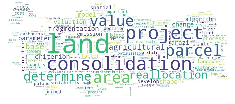
Competency Cloud