Profile URL: https://hdl.handle.net/20.500.13091/11871
Job Title:Prof. Dr.
Email Address:syalpir@ktun.edu.tr
Main Affiliation:02.08. Department of Geomatic Engineering
Status: Current Staff
ORCID: 0000-0003-2998-3197
Scopus ID: 37058085100
YÖK Akademik: B97F718E91480936
Google Scholar: V-fY1qsAAAAJ
Web of Science ID: CKE-3638-2022
Name Variants:
Yalpır, Sükran Yalpir, S.
34 results
Scholarly Output Search Results
Now showing 1 - 10 of 34
Article Citation - WoS: 7Citation - Scopus: 10Evaluating Lake Water Quality With a Gis-Based Mcda Integrated Approach: a Case in Konya/Karapınar(Springer Heidelberg, 2024-02-15) Akar, Ali Utku; Şişman, Süleyman; Ülkü, Harika; Yel, Esra; Yalpır, ŞükranConsidering water quality is an essential requirement in terms of environmental planning and management. To protect and manage water resources effectively, it is necessary to develop an analytical decision-support system. In this study, a systematic approach was suggested to evaluate the lake water quality. The methodology includes the prediction of the values in different locations of the lakes from experimental data through inverse distance weighting (IDW) method, creation of maps by using Geographic Information System (GIS) integrated with analytic hierarchy process (AHP) from multi-criteria decision analysis (MCDA), reclassification into five class, combining the time-related spatial data into a single map to predict the whole lake water quality from the data of sampling points, and finally overlapping the final maps with topography/geology and land use. The proposed approach was verified and presented as case study for Meke and Acigol Lakes in Konya/Turkey which were affected by human and natural factors although they have ecological, hydromorphological, and socio-economic importance. In the proposed approach, categorizing water quality parameters as hardness and minerals, substrates and nutrients, solids content, metals, and oil-grease groups was helpful for AHP with the determined group weights of 0.484, 0.310, 0.029, and 0.046, respectively. Assigning weights within each group and then assigning weights between groups resulted in creating accurate final map. The proposed approach is flexible and applicable to any lake water quality data; even with a limited number of data, the whole lake water quality maps could be created for assessment.Article Citation - WoS: 19Citation - Scopus: 25Valuations of Building Plots Using the Ahp Method(VILNIUS GEDIMINAS TECH UNIV, 2019-02-18) Ünel, Fatma Bünyan; Yalpır, Şükran; Bunyan Unel, FatmaPredicting the value of real estate is a complex endeavor due to the abundance of subjective criteria. Objective consideration of the value-affecting criteria in real estate and regulation of decision support systems will enable the acquisition of more accurate results. In this study, analytic hierarchy process (AHP), a type of multi-criteria decision analysis (MCDA), is used to reproduce coefficients that serve as the basis for real estate valuation. A region in the Selcuklu district of Konya, Turkey was used to test the model created by AHP. Weighted criteria describing areas subjected to purchase/sale were generated by the AHP method and then validated. Additionally, a valuation model was created by the multiple regression analysis (MRA) method for comparison and performance analyses. Weighted values were transformed from AHP points and acquired from the MRA method and then joined with geographic information systems (GIS). Value maps of the study area and purchase/sale values were generated according to these newly created models. The performance comparison and value maps revealed that the AHP method is more successful than the MRA method. This study addressed the complexity of criteria issue by using the original hierarchical structure of AHP and thus contributes to the world economy by enabling the generation of more accurate estimations.Article Konut değerlemede uzman görüşü ve yapay sinir ağı ile modellemelerin karşılaştırılması(2024) Yalpır, Erol; Yalpır, ŞükranBu çalışmada Ankara ili, Yenimahalle ilçesi, Batıkent Bölgesi sınırları içerisinde bulunan konutların öznitelik verileri ve coğrafi konumlarının taşınmaz değerine olan etkileri incelenmiştir. Veri seti düzenlenirken Coğrafi Bilgi Sistemlerinden faydalanılmıştır. Çalışma kapsamında nominal değerleme ve Yapay sinir ağları (YSA) modellemede kullanılmıştır. Bölgedeki taşınmazların elde edilebilecek en yüksek hassasiyet ve en yüksek doğrulukta taşınmaz değer haritaları oluşturularak değer tespitleri yapılmıştır. Modellemede Nominal ve YSA yöntemlerine göre R2 değeri sırayla 0,76 ve 0,89 olarak bulunmuştur. YSA ile daha başarılı piyasa sonuçları tahmin edilmiştir. Nominal değerlemede ise uzman görüşü ile oluşan matematiksel modelin piyasa değerini tahmininin göz ardı edilemeyecek başarı elde ettiğini ve gelecekte modelin güncellemelerle sürdürülebilir olduğu gözlemlenmiştir.Master Thesis Kentsel Fonksiyonlar ve Ekonomik Faktörlerin Taşınmaz Değerine Yansıması: Yapay Sinir Ağları ve Bulanık Mantık Yaklaşımı(2025) Aydoğan, Mücahit; Yalpır, ŞükranTaşınmazların değeri, yalnızca fiziksel özelliklerine değil, aynı zamanda içinde bulundukları kentsel çevrenin sunduğu sosyal, kültürel, ekonomik ve teknik olanaklara da bağlı olarak değişkenlik göstermektedir. Kentsel fonksiyonların taşınmaz değeri üzerindeki belirleyici etkisi, şehirlerin planlama süreçlerinde dikkate alınması gereken temel unsurlardan biri haline gelmiştir. Kentsel alanlarda yer alan taşınmazların değeri, bu alanların çekiciliğini artıran altyapı yatırımları, ulaşım kolaylıkları, sosyal yaşam imkanları ve ekonomik dinamikler ile doğrudan ilişkilidir. Bununla birlikte, her taşınmazın konum, kullanım amacı ve fiziksel nitelikleri açısından benzersiz bir yapıya sahip olması değerinin belirlenmesini güçleştirmektedir. Bu bağlamda, gelişen teknolojiler ve veri analiz yöntemleri sayesinde geleneksel değerleme yaklaşımlarının ötesine geçilerek, daha nesnel ve veri odaklı modelleme yöntemlerinin kullanımı önem kazanmaktadır. Bu çalışmanın temel amacı, taşınmaz değerlemede ekonomik faktörlerin etkisini ortaya koymak ve geleneksel yöntemlerin ötesine geçen yapay zekâ tabanlı yaklaşımlar ile daha nesnel, bütüncül ve güncel bir değerleme modeli geliştirmektir. Böylece hem kamu kurumları hem de özel sektör aktörleri için daha sağlıklı karar destek sistemlerinin oluşturulması hedeflenmektedir. Bu çalışmada, Ankara ili Yenimahalle ilçesine bağlı Batıkent Semti ile Etimesgut ilçesine bağlı Eryaman Semti sınırları içerisinde yer alan 20 mahalledeki taşınmazlara ait 2021, 2023 ve 2024 yıllarına ilişkin emsal verileri kullanılarak; konumsal özellikler, yapısal kriterler ve ekonomik göstergelerin taşınmaz değeri üzerindeki etkileri incelenmiştir. Coğrafi Bilgi Sistemleri (CBS) yardımıyla taşınmazların konumsal analizleri gerçekleştirilmiş, bu analizlerden elde edilen veriler emsal taşınmazların özelliklerine eklenmiştir. Ayrıca, satış tarihine göre dönemin ekonomik göstergeleri de veri setine dahil edilerek kapsamlı bir öznitelik tabanı oluşturulmuştur. Oluşturulan veri seti yapay sinir ağları ve bulanık mantık yöntemleriyle analiz edilerek, taşınmaz değerine etki eden faktörlerin ağırlıkları ortaya konmuş ve taşınmazların tahmini değerleri hesaplanmıştır. Elde edilen sonuçlar doğrultusunda, toplam 3637 adet taşınmaz verisi kullanılarak, taşınmaz değerlemede lineer regresyon analizi, yapay sinir ağları ve bulanık mantık yöntemlerinden yararlanılmıştır. Yapılan analizler sonucunda, lineer regresyon yönteminde %79,92 oranında, YSA yönteminde %89.73 oranında ve bulanık mantık yönteminde %81.23 oranında veri açıklanabilirliği elde edilmiş ve bu bilgiler ışığında tahmini değer haritaları oluşturulmuştur.Master Thesis Makine Öğrenme Algoritmalarının Konut Değer Tahmininde Kullanımı: Ankara Gölbaşı Uygulaması(Konya Teknik Üniversitesi, 2019) Savaş, Burak; Yalpır, ŞükranÜlkemiz ve dünyada taşınmaz değerinin belirlenmesine olan ihtiyaç her geçen gün artmaktadır. Ülke ekonomisinin de önemli bir parçası olan taşınmaz değerleme çalışmalarına vergilendirme, özelleştirme, kamulaştırma gibi birden fazla uygulamalarda rastlanmaktadır. Taşınmazların değerlemesinde tahmini yaklaşımı bulmak için literatürde birçok çalışma vardır. Bu çalışmalarda uygulama alanlarına göre farklı kriterler kullanılmıştır. Başarı seviyeleri kullanılan kriter ve yöntemlere göre değişiklik göstermektedir. Bu çalışmada; uygulama bölgesi Ankara ili Gölbaşı ilçesinden belirlenen 5 mahalleden taşınmaz türü konut olan 95 adet örneklem toplanmıştır. Bu örneklemleri değerlemede ifade eden kriterleri belirlemek için gerçekleştirilen literatür araştırması sonucunda taşınmazın değerini etkileyen 42 kriter ile ana veri seti oluşturulmuştur. Değerlemede kullanılmak üzere hazırlanan ana veri seti kriter azaltma, veri işlemesi, normalizasyon ve ağırlıklandırma adımları sonrasında farklı veri setleri hazırlanmıştır. Çalışmada açık kaynak kodlu Orange Canvas programı kullanılarak Destek Vektör Makineleri (DVM), Destek Vektör Regresyon (DVR), Çoklu Lineer Regresyon (ÇLR) yöntemleri uygulanmış, uygulama sonucunda elde edilen RMSE, MAE, R2 performans sonuçları karşılaştırılmıştır. Ayrıca hazırlanan veri setlerini kullanarak aynı yöntemlerle taşınmazın değerini etkileyen kriterlerin ağırlıklarını belirleme çalışması da yapılmıştır. Modellerin başarıları karşılaştırıldığında kriterlerin ağırlıklandırılması ile hazırlanan veri setlerinde daha başarılı sonuçlar elde edilmiştir. Uygulanan yöntemler arasında DVM yöntemi ile elde edilen performans sonuç değerlerinin diğer yöntemlere göre daha başarılı olduğu gözlemlenmiş olup DVR yöntemininde de çok yakın sonuçlara ulaşıldığı gözlemlenmiştir. Taşınmazın değerine etki eden kriterlerin ağırlık analizlerinde ise her bir veri setinde ve uygulanan her yönteme göre kriterlerin ağırlıkları farklılık gösterdiği görülmüştür. Sonuç olarak bu çalışmada kullanılan DVM, DVR ve ÇLR yöntemleri taşınmaz değerlemede kullanılan klasik yöntemlere karşı alternatif değerleme yöntemi olarak kullanılabilirliği ortaya konulmuş ayrıca toplu değerleme sistemi oluşturma konusunda DVM'nin kullanılabilir olduğu tespit edilmiştir.Article Analyzing the Impact of the 2023 General Elections on Land Prices Using Machine Learning: a Case Study in Çanakkale, Turkey(Konya Teknik Univ, 2025) Yalpır, Sükran; Genç, Levent Genc; Yucebas, Sait Can; Doğan, SimgeThis study analyses the impact of the general elections to be held on 14 May 2023 on the real estate market in Turkey. The aim of the study is to develop a model to predict land unit prices (₺/m²) by analysing land prices, exchange rates and gold values observed before (February-March-April) and after (May-June-July) elections for Ayvacık, Bayramiç, Biga, Çan, Eceabat, Ezine, Gelibolu, Lapseki, Merkez and Yenice districts of Çanakkale province. Daily fluctuations in foreign exchange and gold values, which are the main economic parameters in the study, were recorded during the election period. The findings of this research, which predicts price movements in the property market using machine learning methods such as regression trees, reveal that unit prices of land generally tend to increase with increases in exchange rates, but in some districts where gold prices increase, the unit price shows a reverse trend. This is attributed to the fact that investors prefer gold as a safer asset in times of economic uncertainty. The results obtained can help investors and buyers to predict future trends in property prices, as well as contribute to the development of economic policies by experts to stabilise fluctuations in investment instruments.Master Thesis Taşınmaz Değerlerindeki Mekânsal ve Zamansal Farklılıkların Deprem Riski Bağlamında Analizi: GTWR Modeli Temelli Bir Çalışma(2025) Arslan, Yusuf; Yalpır, ŞükranTaşınmazların doğru ve güvenilir biçimde değerlenesi hem bireysel karar alma süreçleri hem de ülke ekonomisinin sürdürülebilirliği açısından kritik bir öneme sahiptir. Bir taşınmazın değeri; yapısal nitelikleri, konumsal özellikleri, çevresel koşulları ve ekonomik göstergeleri kapsayan çok boyutlu bir etkileşimle şekillenmektedir. Buna ek olarak, doğal afetler, salgınlar veya sosyo-politik dalgalanmalar gibi olağan dışı olaylar da taşınmaz piyasalarında ani ve belirgin kırılmalara yol açabilmektedir. Bu kapsamda çalışma, 06 Şubat 2023 tarihinde meydana gelen Kahramanmaraş merkezli depremin etkilerinin en yoğun hissedildiği alanlardan biri olan Kahramanmaraş İli Onikişubat Merkez İlçesi üzerinde gerçekleştirilmiştir. Çalışmada, deprem öncesi ve sonrası dönemleri kapsayacak şekilde 2022, 2023 ve 2025 yıllarına ait yaklaşık 2704 konutun satış verileri farklı emlak platformlarından derlenmiş, düzenlenmiş ve bütünleştirilerek anlamlı bir veri seti oluşturulmuştur. Elde edilen veriler Coğrafi Bilgi Sistemleri ortamına aktarılmış, koordinat bilgileri işlenmiş ve taşınmaz değerleri üzerinde etkili olan ulaşım, kamusal hizmetler, sosyal donatı alanları ve jeolojik risk faktörleri gibi mekânsal bağımlılığı yüksek mesafe değişkenleri hesaplanmıştır. Ayrıca parsel sorgu ve OpenStreetMap gibi açık kaynak platformlardan alınan yaklaşık 31.000 parsel verisi de çalışma alanına entegre edilerek bölgenin mekânsal yapısını yansıtan kapsamlı bir altlık oluşturulmuştur. Taşınmaz değerlerini açıklama ve tahmin etme amacıyla Çoklu Regresyon (OLS), Coğrafi Ağırlıklı Regresyon (GWR) ve Coğrafi ve Zamansal Ağırlıklı Regresyon (GTWR) yöntemleri kullanılmış; modeller karşılaştırmalı olarak değerlendirilmiştir. Elde edilen sonuçlar, mekânsal ve zamansal heterojenliğin yüksek olduğu Onikişubat ilçesinde klasik regresyonun yetersiz kaldığını, GWR modelinin mekânsal değişkenliği daha iyi yakaladığını, GTWR'nin ise hem zaman hem de mekân etkilerini bütünleştirerek en yüksek tahmin doğruluğunu sağladığını ortaya koymuştur. Model performansları; R², RMSE, MAE ve MAPE gibi ölçütler kullanılarak detaylı şekilde analiz edilmiş ve yöntemlerin güçlü ve zayıf yönleri tartışılmıştır. Bu çalışma, deprem sonrası değer değişiminin mekânsal dağılımını, risk zonları ile ilişkisini ve taşınmazın değerini belirleyen faktörlerin bölgesel farklılaşmasını ortaya koyması bakımından hem akademik literatüre katkı sağlamakta hem de yerel yönetimlerin, yatırımcıların ve planlama otoritelerinin karar alma süreçlerine önemli girdiler sunmaktadır.Article Citation - WoS: 18Citation - Scopus: 17Sustainable Tax System Design for Use of Mass Real Estate Appraisal in Land Management(Elsevier Sci Ltd, 2023-08-01) Bünyan Ünel, Fatma; Yalpır, Şükran; Unal, Fatma BunyanSustainable land management aims at land use by protecting nature. Real estate value is one of the important parts of land management, especially at the decision stages. The value associated with a major part of domestic real estate is tax value. The purpose of this study is to develop a tax system that is easy to understand and use as well as compatible with innovations. The sustainability of mass real estate appraisal is provided with legal, physical, locational, neighborhood and economic criteria according to ordinary and extraordinary conditions. The plots reserved for housing in urban areas were selected as the real property type with updates regarding appraised value for taxation. Valuation stages were discussed separately from general to detail, and coefficients were used under the current tax law. Sustainable mass plot appraisal system was designed by providing sustainable cycle economic and extraordinary criteria. The application was carried out in Konya/Lalebahce Neighborhood and the sustainability of the system was observed. A multiple regression model was created from the samples of 2015 and the real estate value estimation was made with the data of the criteria affecting the value. With the model obtained from the economic criteria of 2005-2015, the economic valuation rate of real estate was found for the years 2016-2021. The results were compared with 10 market sample data for the years 2020-2021. The values estimated by the economic valuation rate of the real estate in 2020 approached the market values with an average of +/- 7 % standard deviation and in 2021 with a +/- 14 % standard deviation. A sustainable mass appraisal system for taxation was successfully tested and its sustainability was observed.Review Citation - WoS: 9Citation - Scopus: 11Assessment of Suitable Shrimp Farming Site Selection Using Geographical Information System Based Analytical Hierarchy Process in Turkey(Elsevier Ltd, 2023-03-01) Akdeniz, H.B.; Yalpir, S.; Inam, S.In the last century, the increasing global population and the demand for animal food have caused the limit of the fishing and wild harvest production capacity to be reached. In order to ensure sustainability in the fishing and wild harvest, it is necessary to focus on aquaculture activities. When it is planned to open a new aquaculture facility, the first step to be taken is to determine the most suitable establishment site. Suitable site selection affects both the success and sustainability of any aquaculture development. The aim of this study is to determine the most suitable areas to establish shrimp farming facilities in the Mediterranean Region of Turkey by using Analytical Hierarchy Process (AHP) which are among the Multi-Criteria Decision-Making methods and Geographic Information Systems. In the first stage, analyses of airports, ports, hotels and feed mill businesses in the Mediterranean Region were conducted. Second stage study was performed on the most suitable area determined as a result of the analysis. Within the scope of this purpose, eleven sub-criteria that will affect the facility location were determined under three main criteria (land, water availability, infrastructure and socio-economic). Constraint criteria were determined to exclude areas where shrimp farming facilities are not allowed to be established. As a result of the analysis, it was specified that 0.01% of the study area is highly suitable, 0.87% suitable, 4.69% moderately suitable and 94.43% unsuitable. This study showed that the AHP method and geographical information system techniques are applicable in the selection of suitable areas for greenhouse shrimp farming. © 2022 Elsevier LtdArticle Citation - WoS: 12Citation - Scopus: 11Reduction of Mass Appraisal Criteria With Principal Component Analysis and Integration To Gis(Selcuk Univ Press, 2019-10-01) Ünel, Fatma Bünyan; Yalpır, ŞükranIn real estate, mass appraisal is a very important subject in the valuation of two and more properties. It can be of benefit in a number of fields including taxation, banking transactions, expropriation, etc. The base problem is which criteria to use for mass appraisal. Because the number of criteria and the criteria themselves vary according to people, regions and countries, they are uncertain. They should be optimum in order to save on time, labour and cost. The aim of this study is to reduce the criteria by determining which ones affect the plot value. A survey which was answered by a total of 2,531 participants was conducted in Turkey. Principal Component Analysis (PCA), one of the criteria analysis methods, was applied to the survey data. The number of criteria was reduced to 14 with separation and to 30 according to the results of PCA. But they decreased in the model verification when criteria data for 558 samples were collected in the Konya study area. An index of the neighbourhood and locational features of these criteria was created by using GIS. Three models were established using Multiple Regression Analysis (MRA) and the performance of the models was examined. The prediction values and the market value were integrated into the GIS to compare the spatial distributions of plot values.
Research Topics
Domains
Physical SciencesSocial SciencesLife Sciences
Fields
Environmental ScienceEconomics, Econometrics and FinanceDecision SciencesEngineeringAgricultural and Biological Sciences
Subfields
Management, Monitoring, Policy and LawEconomics and EconometricsManagement Science and Operations ResearchElectrical and Electronic EngineeringForestry
Specific Research Areas
Soil and Land Suitability Analysis
Housing Market and Economics
Multi-Criteria Decision Making
Energy Load and Power Forecasting
Agricultural and Rural Development Research
Sustainable Development Goals
 11
SUSTAINABLE CITIES AND COMMUNITIES
6
Research Products
 12
RESPONSIBLE CONSUMPTION AND PRODUCTION
6
Research Products
 9
INDUSTRY, INNOVATION AND INFRASTRUCTURE
6
Research Products
 2
ZERO HUNGER
4
Research Products
 8
DECENT WORK AND ECONOMIC GROWTH
4
Research Products
 15
LIFE ON LAND
3
Research Products
 17
PARTNERSHIPS FOR THE GOALS
3
Research Products
 7
AFFORDABLE AND CLEAN ENERGY
2
Research Products
 4
QUALITY EDUCATION
2
Research Products
 13
CLIMATE ACTION
2
Research Products
 6
CLEAN WATER AND SANITATION
2
Research Products
 14
LIFE BELOW WATER
1
Research Products

Documents
22
Citations
303
h-index
11

Documents
23
Citations
280
Publication Collaboration
| Affiliation Name | Count |
|---|---|
| Konya Technical University | 22 |
| Selçuk University | 12 |
| Gebze Technical University | 5 |
| Mersin Üniversitesi | 4 |
| Çanakkale Onsekiz Mart Üniversitesi | 2 |
1 / 2
Data obtained from OpenAlex
| Journal | Count |
|---|---|
| Afyon Kocatepe Üniversitesi Fen ve Mühendislik Bilimleri Dergisi | 3 |
| Clean Technologies and Environmental Policy | 1 |
| Computers and Electronics in Agriculture | 1 |
| Environmental Monitoring and Assessment | 1 |
| Environmental Science And Pollution Research | 1 |
Current Page: 1 / 5

Scholarly Output
34
Articles
25
Views / Downloads
88/185
Supervised MSc Theses
8
Supervised PhD Theses
0
WoS Citation Count
111
Scopus Citation Count
123
Patents
0
Projects
0
WoS Citations per Publication
3.26
Scopus Citations per Publication
3.62
Open Access Source
21
Supervised Theses
8
Scopus Quartile Distribution
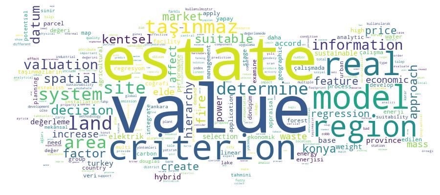
Competency Cloud