Profile URL: https://hdl.handle.net/20.500.13091/11885
Job Title:Dr. Öğr. Üyesi
Email Address:ezozturk@ktun.edu.tr
Main Affiliation:02.08. Department of Geomatic Engineering
Status: Current Staff
ORCID: 0000-0002-7498-5258
Scopus ID: 57190856553
YÖK Akademik: 498565AB8A5DD011
Google Scholar: 09H7qZ8AAAAJ
Web of Science ID: OGP-5479-2025
Name Variants:
Öztürk, Emel Zeray Ozturk, Emel Zeray
13 results
Scholarly Output Search Results
Now showing 1 - 10 of 13
Master Thesis Grace Verileri ile Türkiye'de Karasal Su Depolama Değişimlerinin ARX Modeli ile Tahmin Edilmesi(2026) Porsuk, Uğur; Öztürk, Emel ZerayKarasal su depolama (TWS: Terrestrial Water Storage), su döngüsünün temel bileşenlerinden biri olup yeraltı suyu, toprak nemi, yüzey suyu ve kar örtüsünü birlikte temsil etmektedir. Bu tez çalışmasında, GRACE (Gravity Recovery and Climate Experiment) ve GRACE-FO (GRACE Follow-On) uydu verileri kullanılarak Türkiye üzerindeki karasal su depolama anomalilerinin (TWSA: Terrestrial Water Storage Anomaly) zamansal değişimi incelenmiş ve bu değişimlerin veri temelli yöntemlerle tahmin edilebilirliği araştırılmıştır. Çalışmada TWSA verileri, GLDAS (Global Land Data Assimilation System) tabanlı toprak nemi, PREC/L (Precipitation Reconstruction over Land) yağış verisi, ERSST (Extended Reconstructed Sea Surface Temperature) deniz yüzeyi sıcaklığı ve AO (Arctic Oscillation), NAO (North Atlantic Oscillation), NOI (Niño Oceanic Index) iklim indeksleri ile birlikte analiz edilmiştir. Yöntem olarak, veri setleri PCA (Principal Component Analysis) ile boyut indirgemeye tabi tutulmuş, STL (Seasonal-Trend Decomposition using Loess) yöntemi ile zaman serileri ayrıştırılmış ve değişkenler arasındaki gecikmeli ilişkiler belirlenerek ARX (Autoregressive Model with Exogenous Inputs / Dışsal Değişkenli Otoregresif Model) modeli ile 12 aya kadar ileriye yönelik tahminler gerçekleştirilmiştir. Elde edilen sonuçlar, modelin kısa ve orta vadeli tahminlerde genel eğilim ve faz değişimlerini başarılı şekilde yakalayabildiğini, ancak yüksek genlikli ve ani anomalilerde performansının azaldığını göstermektedir. Ayrıca modelin yıllar arası bileşenlerde daha başarılı, mevsim altı bileşenlerde ise daha sınırlı performans sergilediği belirlenmiştir. Bu çalışma, GRACE tabanlı TWSA verilerinin Türkiye ölçeğinde veri temelli yöntemlerle tahmin edilebileceğini ortaya koymakta ve hidrolojik değişimlerin izlenmesi ve öngörülmesi açısından literatüre katkı sağlamayı amaçlamaktadır.Doctoral Thesis Uydu Gravimetrisi ile Fiziksel Yükseklik Değişimlerinin Belirlenmesi ve Analizi: Türkiye ve Grönland Örneği(Konya Teknik Üniversitesi, 2020) Zeray Öztürk, Emel; Abbak, Ramazan AlpayOkyanus, atmosfer ve kıtalardaki su döngüsünün sürekli devam ediyor oluşu, yeryuvarı gravite alanında hızlı değişimlere yol açar. Yersel gravite ölçmeleriyle bu değişimler ancak bölgesel olarak tespit edilebilmekte ve fazla zaman ile yüksek maliyet gerektirmektedir. Yapay uydularla global ölçekte zamana bağlı değişen gravite alanını tespit etmek oldukça kolay hale gelmiş, global jeopotansiyel model üretme çalışmaları hız kazanmıştır. Bu amaçla geliştirilen GRACE (Gravity Recovery and Climate Experiment) (2002–2017) uydu misyonu sahip olduğu uydu gravimetri teknolojisi ile, yeryuvarı dinamik sisteminin anlaşılmasına büyük katkı sağlamaktadır. 2002 yılından itibaren global iklim sistemlerindeki değişimin yeryüzüne etkisi, kıtasal su havzalarındaki döngüleri, deniz seviyesi değişimleri ve buzul hareketleri gibi pek çok doğa olayının izlenmesinde oldukça başarılı bir sisteme sahip olan GRACE uydu misyonu, sunduğu yüksek çözünürlüklü veri ile zamana bağlı değişen gravite ve fonksiyonlarına dair tüm çalışmalara ışık tutmuştur. Yer bilimlerinde oldukça önem arz eden, mühendislik projelerinin olmazsa olmazı fiziksel yüksekliklerin referans yüzeyi olan jeoit bu misyon ile daha yüksek doğrulukta belirlenebilmekte, zamana bağlı değişimlerini izlemek de mümkün olmaktadır. Yükseklik sistemlerini güncellemek ve modernizasyonunu sağlamak için zamana bağlı fiziksel yükseklik değişimlerini tanımlamak ve modellemek gerekir. Bu çalışmada Türkiye ve Grönland bölgeleri olmak üzere iki farklı çalışma alanında GRACE global jeopotansiyel modeli ve WaterGAP (Water – a Global Assessment and Prognosis) Global Hidroloji Modeli (WGHM) kullanılarak fiziksel yükseklik değişimleri araştırılmıştır. Türkiye bölgesinde fiziksel yükseklik değişimlerinin kestiriminde Green fonksiyonu ve Terzaghi prensibi yaklaşımları da kullanılmış ve elde edilen fiziksel yükseklik değişimleri her iki çalışma alanında da mevsimsel ayrışma yöntemi (MA) ve temel bileşenler analizi/ampirik ortogonal fonksiyon (PCA/EOF) yöntemi ile analiz edilerek modellenmiştir. Ayrıca, C/C++ programlama dilinde GRACE global jeopotansiyel modelleri yardımıyla kullanıcıların fiziksel yükseklik ve jeoit yükseklik değişimlerini ve asismik yüzey hareketlerinin zamansal değişimlerini istenen noktada hesaplamalarını ve zaman serilerini çizmelerini sağlayan PHCSOFT yazılımı geliştirilmiştir.Article Assessment of Multiple GRACE Solutions for Estimation of Terrestrial Water Storage Trends over Türkiye(Springer, 2026) Şimşek, Hilal; Öztürk, Emel ZerayTurkiye's semi-arid climate and intense anthropogenic pressures make monitoring long-term water storage changes critical. In this study, terrestrial water storage anomalies (TWSA) were derived from Gravity Recovery and Climate Experiment (GRACE) satellite data using four spherical harmonic solutions (COST-G, JPL, CSR, and GFZ) and one mascon solution (GSFC-M) for the period 2002-2024. This study provides the first comprehensive Turkiye-scale assessment of TWSA derived from multiple GRACE spherical harmonic and mascon solutions. Theil-Sen, Mann-Kendall, and seasonal-trend decomposition using loess analyses were employed, and the findings showed significant (p < 0.01) negative trends for all solutions. The spherical harmonic solutions showed mean trends ranging from - 6.2 to - 6.5 km(3)/year while the mascon solution showed a weaker trend of - 4.6 km(3)/year. The trend maps showed significant losses from central Anatolia toward eastern Turkiye but limited gains northward. The inter-solution uncertainty was highest in the eastern Black Sea and southeastern regions, with 3-5 mm/year, and lowest in the Marmara and Aegean regions. The findings indicate that changes in TWSA in Turkiye are spatially heterogeneous and that the combined use of multiple GRACE products increases the reliability of the trends.Article Evaluation of Water Storage Changes in Southeastern Eanatolia, Turkey, Using Grace and Gldas(Inst Meteorology & Water Management, 2022) Öztürk, Emel ZerayWith climatic changes, access to freshwater resources becomes more limited Correspondingly, water monitoring methods in sensitive or critical areas in terms of groundwater amount are becoming increasingly important. The monitoring of the water levels in these regions, using appropriate methods and data sets, is highly effective in preventing possible future water crises. This paper aims estimated water storage changes with available tools and data in southeastern Anatolia, Turkey, where hydroclimatological studies are scarce due to limited observations. Data obtained from the Gravity Recovery and Climate Experiment satellite mission and the Global Land Data Assimilation System were used for the analysis of water storage changes in the study area. The results demonstrate that water storage shows a downward trend in all subareas, particularly in high-elevation regions. In addition, climatic changes have both short- and long-term impacts on water storage. Climatic variables (increasing temperature and decreasing precipitation) showed the highest correlation with water storage at 2-month lags. The monitoring of water storage is crucial for the region, and our results confirm the major role of such monitoring in decision-making processes and water resource management.Article Citation - WoS: 4Citation - Scopus: 3Phcsoft: a Software Package for Computing Physical Height Changes From Grace Based Global Geopotential Models(SPRINGER HEIDELBERG, 2020-08-02) Zeray Öztürk, Emel; Abbak, Ramazan Alpay; Ozturk, Emel ZerayPhysical height changes play an important role in the modernization of national/international levelling networks in the discipline of geodesy. This paper represents a software package, named PHCSOFT (Physical Height Changes SOFTware) which allows to compute and plot physical height changes from Global Geopotential Models (GGMs) based on a monthly interval GRACE (Gravity Recovery and Climate Experiment) satellite mission data. The software has the ability to plot time series of computed temporal variations of geoid heights as well as temporal variations of surface deformations in up component, rapidly. In this contribution, the performance of software was tested at a point in Greenland. Accordingly, PHCSOFT is an alternative software package with its algorithm that speeds up the computation of physical height changes using GGMs from three GRACE computation centers.Article Citation - WoS: 11Citation - Scopus: 9Estimation of Physical Height Changes From Grace Satellite Mission Data and Wghm Over Turkey(SPRINGER, 2020-05-05) Zeray Öztürk, Emel; Godah, Walyeldeen; Abbak, Ramazan AlpayGravity Recovery and Climate Experiment (GRACE) satellite mission had provided gravity data for ca. 15 years, completed its mission in 2017 and handed over to GRACE Follow-On. During its active life, GRACE contributed to the understanding of temporal variations of geoid/quasigeoid heights as well as vertical and horizontal displacements of the Earth's surface induced by mass loading, and thereby the physical height (e.g. the orthometric/normal height) changes. The main objective of this research is to estimate physical height changes over the area of Turkey. The release 6 GRACE-based global geopotential models and WaterGAP (Water-a Global Assessment and Prognosis) Global Hydrology Model products as well as load Love numbers from the Preliminary Reference Earth Model were used as input data. Physical height changes over Turkey were estimated using three different approaches: the GRACE-based Global Geopotential Models, the Green's function, and the Terzaghi's principle. The estimated physical height changes were analysed and modelled by means of the seasonal decomposition method and the Principal Component Analysis/Empirical Orthogonal Function method. The main findings reveal that physical height changes over Turkey reach the level of a few centimetres during years 2004-2010.Article Citation - WoS: 1Gis-Ahp Approach for a Comprehensive Framework To Determine the Suitable Regions for Geothermal Power Plants in İzmir, Türkiye(Konya Teknik Univ, 2024) Koca, Kemal; Karipoğlu, Fatih; Öztürk, Emel ZerayGeothermal energy is gaining more reputation and importance around the world. Correspondingly, suitable location selection is a critical step and has become necessary for the successful installation and operation of geothermal power plants. This study investigated suitability of İzmir region, located in the Aegean part of Türkiye, in terms of geothermal power plants applications by using the combination of Geographical Information System and Analytic Hierarchy Process. Based on the request of power plants, thirteen important criteria were evaluated under three main categories named as physical (C1), environmental (C2) and technical (C3). Moreover, expert’s opinions were taken into consideration to calculate the importance of these criteria. Key results showed that İzmir was suitable for geothermal power plants. The final suitability map layer pointed out that %8.73 (1.037 km2) of total area were determined as highly suitable regions in terms of installation. In addition, the obtained suitability map layer was compared with actual geothermal power plants. Based on the comparison study, power plants in Seferihisar were moderately suitable for geothermal power plants while the location of Balçova power plant was highly suitable. Regarding the suitability assessment in the present study, the location of Dikili power plants had the least suitability score.Master Thesis Türkiye'de Farklı GRACE Çözümleri ile Karasal Su Kütle Trend Kestirimlerinin Karşılaştırılması(2025) Şimşek, Hilal; Öztürk, Emel ZerayKüresel iklim değişikliği, hidrolojik döngünün dengesini bozarak karasal su kütlesinin dağılımında önemli değişimlere yol açmaktadır. 2002 yılından günümüze kadar GRACE (Gravity Recovery And Climate Experiment) ve GRACE-FO (GRACE Follow-On) uydu misyonları, yerçekimi alanı ve su kütlelerindeki küresel değişimleri, hidrolojik olayları ve jeoit yüksekliği farklılıklarını inceleme olanağı sağlamıştır. Bu çalışmada, GRACE uydu misyonlarından elde edilen karasal su depolama anomalileri (TWSA), 2002–2024 dönemi için dört küresel harmonik çözümden (COST-G, JPL, CSR, GFZ) ve bir mascon çözümünden (GSFC-Mascon) türetilmiştir. Çalışma kapsamında, Türkiye genelinde GRACE küresel harmoniklerinin ayrıntılı işlenmesi sunulmuş ve bu ürünlerden TWSA alanı hesaplanmıştır. Analizlerde Theil–Sen, Mann–Kendall ve STL (Loess kullanarak mevsimsel trend ayrıştırma) yöntemleri uygulanmış; bulgular, tüm çözümler için istatistiksel olarak anlamlı (p<0,01) negatif eğilimler ortaya koymuştur. Küresel harmonik çözümler ortalama olarak −5,9 ile −6,2 km3/yıl arasında bir azalma eğilimi gösterirken, mascon çözümü −4,6 km3/yıl oranında azalma sergilemiştir. Eğilim haritaları, Orta Anadolu'dan ülkenin doğusuna doğru belirgin su kayıplarını, kuzey bölgelerde ise sınırlı artışları göstermektedir. Çözümler arası belirsizlik, 3–5 mm/yıl ile en yüksek Doğu Karadeniz ve Güneydoğu Anadolu bölgelerinde, en düşük ise Marmara ve Ege bölgelerindeBgözlemlenmiştir. Elde edilen bulgular, Türkiye'deki TWSA değişimlerinin mekânsal olarak heterojen olduğunu ve birden fazla GRACE ürününün birlikte kullanılmasının eğilimlerin güvenilirliğini artırdığını göstermektedir.Article Grace Misyonu ve Gldas Modeli ile Su Kütlesi Değişimlerinin İzlenmesi ve İklimsel Faktörlerin Değişimlere Etkisi: Konya Havzası Örneği(2022) Öztürk, Emel ZeraySon yıllarda gözlemlenen iklim değişimleri, su kaynaklarının etkin kullanımını gerektirmektedir. Bu bakımdan sürdürülebilir su yönetimi için izlenen politikalar, su hareketliliğinin sürekli izlenmesini zorunlu kılmaktadır. Su kaynaklarının takibini, trend kestirimlerini ve su alanlarındaki değişimin görselleştirilmesine yönelik harita üretimini, son yıllarda uzaktan algılama teknolojisi ile gerçekleştirilebilmek mümkündür. Özellikle uydu gravimetrisi ve global hidrolojik modellerin entegrasyonu ile bu çalışmalar görece hızlı ve düşük maliyetle yürütülebilmektedir. Bu çalışmada GRACE (Gravity Recovery and Climate Experiment) uydu misyonu ve GLDAS (Global Land Data Assimilation System) kara hidroloji model verileri kullanılarak Konya havzasının bulunduğu bölgede su kütlesi değişimleri (TWSA: Total Water Storage Anomaly) irdelenmiştir. Ayrıca iklim değişimlerinin sonuçlar üzerindeki kısa ve uzun dönemdeki etkileri araştırılmıştır. Elde edilen sonuçlar, 2002-2020 yılları arasında çalışma bölgesindeki yeraltı su kütlesi (YSK) ve buna bağlı olarak toplam su kütlesi değişimlerinin uzun dönemde negatif yönlü trende sahip olduğunu göstermektedir. Bununla birlikte, TWSA ile iklim değişkenlerinden sıcaklık ve yağış faktörlerinin iki ve üç aylık gecikme dönemlerinde yüksek korelasyona sahip olduğu anlaşılmaktadır.Publication Validations of Three Global Gravity Field Models Using the QDaedalus System Observed Astrogeodetic Vertical Deflections in the Munich Region, Germany(2021) Hirt, Christian; Bildirici, İbrahim Öztuğ; Bevis, Michael; Albayrak, Müge; Guillaume, Sébastien; Shum, C. K.; Öztürk, Emel Zeray<p>The total station-based QDaedalus system, developed in 2014 by ETH Zurich in Switzerland, incorporates a charge-coupled device (CCD) camera in support of daytime geodetic and nighttime astrogeodetic observations. The successful realization of astrogeodetic observations has resulted in astrogeodetic vertical deflection (VD) data collection in Germany, Italy, Hungary, Australia, and Turkey. Astrogeodetic observations carried out in Munich, Germany were used to determine the precision and accuracy of the newly installed QDaedalus system, which was found to be ~0.2 arcseconds for both the North-South (N-S) and East-West (E-W) VD components. In this study, 10 benchmark observations in the Munich region were also used to assess the quality of three global gravity field models&#8212;Global Gravitation Model Plus (GGMplus), Earth Residual Terrain Modelled 2160 (ERTM2160) and Earth Gravitational Model 2008 (EGM2008)&#8212;through comparison with the QDaedalus observations. The results of these comparisons between the predicted and observed VD data are: (i) The GGMplus predicted VD values were found to be closer to the observed VDs, with the differences for both the N-S and E-W VD components being ~0.2&#8243;, and reaching a maximum of 0.3&#8243; and 0.4&#8243; for the N-S and E-W components, respectively; (ii) The ERTM2160 predicted values were also found to be closer to the observed VDs, with differences of 0.4&#8243; or less for the N-S component, with the exception of one benchmark (BM 8), and 0.2&#8243; or less for the E-W component, with the exception of one benchmark (BM 9); and, (iii) When the predicted VDs computed using EGM2008 were analysed, we found that they were less accurate than the predicted GGMplus and ERTM2160 values. Therefore, the maximum differences between the observed and EGM2008 predicted VD data were for 0.9&#8243; N-S and 1.8&#8243; for E-W. Finally, we conclude with a comparison of the results of this Munich Region study with the results of a prior QDaedalus study, which was conducted in Istanbul (Albayrak et al. 2020), to assess the accuracy of the EGM2008 and GGMplus models.</p><p>&#160;</p><p>Albayrak, M., Hirt, C., Guillaume, S., Halicioglu, K., &#214;zl&#252;demir, M.T., Shum, C.K., 2020. Quality assessment of global gravity field models in coastal zones: a case study using astrogeodetic vertical deflections in Istanbul, Turkey, Studia Geophysica et Geodaetica, <strong>64</strong>(3), 306&#8211;329. doi: 10.1007/s11200-019-0591-2</p>
Research Topics
Domains
Physical SciencesLife Sciences
Fields
Earth and Planetary SciencesEngineeringEnvironmental ScienceBiochemistry, Genetics and Molecular Biology
Subfields
OceanographyAerospace EngineeringWater Science and TechnologyGeophysicsMolecular BiologyEnvironmental EngineeringOcean Engineering
Specific Research Areas
Geophysics and Gravity Measurements
GNSS positioning and interference
Hydrology and Watershed Management Studies
Geophysical and Geoelectrical Methods
Geomagnetism and Paleomagnetism Studies
Soil Moisture and Remote Sensing
Geophysics and Sensor Technology
Sustainable Development Goals
 13
CLIMATE ACTION
2
Research Products
 12
RESPONSIBLE CONSUMPTION AND PRODUCTION
1
Research Products
 7
AFFORDABLE AND CLEAN ENERGY
1
Research Products
 6
CLEAN WATER AND SANITATION
1
Research Products

Documents
4
Citations
21
h-index
3

Documents
6
Citations
39
Publication Collaboration
| Affiliation Name | Count |
|---|---|
| Konya Technical University | 11 |
| Swedish Meteorological and Hydrological Institute | 3 |
| University of Ljubljana | 2 |
| Forschungszentrum Jülich | 2 |
| University of Oslo | 2 |
1 / 24
Data obtained from OpenAlex
| Journal | Count |
|---|---|
| ACTA GEODAETICA ET GEOPHYSICA | 1 |
| Communications Earth & Environment | 1 |
| Doğal Afetler ve Çevre Dergisi | 1 |
| EARTH SCIENCE INFORMATICS | 1 |
| Konya mühendislik bilimleri dergisi (Online) | 1 |
Current Page: 1 / 2

Scholarly Output
13
Articles
8
Views / Downloads
27/26
Supervised MSc Theses
2
Supervised PhD Theses
1
WoS Citation Count
16
Scopus Citation Count
12
Patents
0
Projects
0
WoS Citations per Publication
1.23
Scopus Citations per Publication
0.92
Open Access Source
8
Supervised Theses
3
Scopus Quartile Distribution
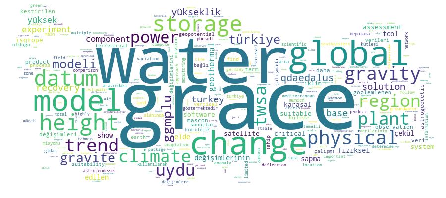
Competency Cloud