Profile URL: https://hdl.handle.net/20.500.13091/11691
Job Title:Prof. Dr.
Email Address:cinal@ktun.edu.tr
Main Affiliation:02.08. Department of Geomatic Engineering
Status: Current Staff
ORCID: 0000-0001-8980-2074
Scopus ID: 24587100500
YÖK Akademik: 4720106DDD4B36CC
Google Scholar: c7KPLKAAAAAJ
Web of Science ID: AAB-2567-2022
Name Variants:
Inal, Cevat
36 results
Scholarly Output Search Results
Now showing 1 - 10 of 36
Article Point Positioning Performance of Trimble-Rtx in Different Satellite Combinations(2022-12-03) Bilgen, Burhaneddin; İnal, Cevat; Bülbül, SercanToday, new global positioning algorithms, techniques and technologies are emerging thanks to services such as International Global Navigation Satellite Systems (GNSS) Service (IGS) that offer orbit and clock correction data of satellite systems to all GNSS users. These solutions are developed in order to eliminate the disadvantages of current positioning techniques such as requiring more than one GNSS receiver and not exceeding a certain distance between the reference station and the rover. One of these innovative technology products is Trimble CenterPoint RTX Post-Processing (Trimble-RTX) technology. In this study, the point positioning performance of the Trimble-RTX service was investigated. The 31-day RINEX data obtained from 2 IGS stations are used in 4 different satellite combinations (GPS (G), GPS+GLONASS (G+R), GPS+GALILEO (G+E), GPS+GLONASS+GALILEO (G+R+E)) processed with Trimble-RTX. By comparing the obtained coordinates with the coordinates of the stations published by IGS, the accuracy and precision of the coordinates were evaluated for each satellite combination. As a result of the evaluation, it was seen that there were generally no significant differences between the results obtained from 4 different satellite combinations at the stations.Article The Effect of The Aegean Sea Earthquake, Occurred on October 30, 2020, on Tusaga Stations(Konya Teknik Univ, 2023) Gündogan, Tunahan; Bülbül, Sercan; İnal, CevatGNSS is used to determine the point positions on the earth with high accuracy. The accuracy that can be achieved with GNSS depends on the satellite system, processing software, logging interval, observation time, etc. varies depending on the effects. In the study, the impact of the Aegean Sea Earthquake that occurred on November 30, 2020, on TUSAGA was investigated. For this purpose, 7 TUSAGA stations located in the earthquake-affected area were selected. The 24-hour RINEX data for these stations were obtained both 15 days before and after the earthquake. The 24-hour RINEX data of 7 TUSAGA were processed using the GAMIT/GLOBK, based on 14 IGS stations. Furthermore, the evaluations were repeated by dividing the 24-hour RINEX data into 2, 4, and 12-hour intervals. In the evaluation, the GPS+GLONASS+Galileo (MIX) satellite configuration was utilized. The daily solutions obtained to reveal the effect of the earthquake are divided into two parts as before/after the earthquake. For each of TUSAGA stations, pre- and post-earthquake coordinates and RMSE were calculated. With statistical tests, whether the changes in the points are significant or not, the amount and direction of the changes were determined with 95% statistical confidence. As a result, it was concluded that the changes before/after the earthquake were mostly in the MNTS, which is the closest to the earthquake base, the changes in the points generally decrease as you move away from the earthquake center, and the evaluation before/after the earthquake can be made more healthy as the observation time increases. In addition, 30-day coordinates were examined through time series, and only the graph of the change in MNTS was given since it was the closest station to the epicenter of the earthquake.Article Citation - WoS: 6Citation - Scopus: 5Statistical Comparison on Accuracies of Web-Based Online Ppp Services(Asce-Amer Soc Civil Engineers, 2022) Bilgen, Burhaneddin; Bülbül, Sercan; İnal, CevatThe precise point positioning technique (PPP), an absolute positioning method, is widely used in geodetic point positioning. This study investigates the accuracy of the technique through statistical comparisons of the root mean square errors (RMSE), which arc calculated with coordinates obtained from online PPP services. For this purpose, we carried out a two-stage investigation. First, we chose two days, a high geomagnetic activity day and a quiet one. During the high geomagnetic activity day, the Kp index went above 7, and the Dst was below -170nt We uncovered the effect of geomagnetic activity by using the Automatic Precise Positioning Service (APPS), Canadian Spatial Reference System Precise Point Positioning (CSRS-PPP), and magic Global Navigation Satellite System (magicGNSS) PPP services. The results show that the three-dimensional (3D) RMSE are similar to 1.5 times higher during the high geomagnetic activity day during 1-, 2-, 4-, and 6-h session durations, than in the quiet day. However, when the session duration increases to 24 h, the effects of geomagnetic activities are significantly eliminated. In the second stage, we chose 31 consecutive days without significant geomagnetic activities and obtained PPP-derived coordinates for 1-, 2-, 4-, 6-, and 24-h from APPS, CSRS-PPP, magicGNSS, and Trimble real-time extended (RTX). We compared the PPP-derived coordinates with Australian Online GPS Processing Service (AUSPOS)- and Online Positioning User Service (OPUS)-derived reference coordinates. As a result, we determined that, as the session duration increases, the 3D RMSE decreases, and therefore the position accuracy increases. In terms of 3D RMSE, CSRS-PPP yielded the best results in all scenarios. Finally, we concluded that 3D RMSE decreased by approximately 55.8%, 18.1%, 7.7%, and 6.2%, when session durations increased from 1 h to 2 h, 2 to 4 h, 4 to 6 h, and 6 to 24 h, respectively. (C) 2022 American Society of Civil Engineers.Master Thesis Hidrografik Ölçmeler ile Barajlardaki Sediment Miktarlarının Belirlenmesi(Konya Teknik Üniversitesi, 2019) Gülçiçek, Pelin Fakıoğlu; İnal, CevatKüresel iklim değişikliğinden kaynaklanan hem dünyada hem de ülkemizde hissedilen kuraklık nedeniyle, mevcut su kaynaklarımızın etkili yönetilmesi ve doğru yönde kullanılarak sürdürülebilir bir kaynak haline getirilmesi zorunlu hale gelmiştir. Bu nedenle mevcut su kaynaklarımız ile ilgili pek çok konuya daha dikkatli yaklaşmamız gerekmektedir. Kontrolsüz su taşkınlarıyla veya akarsular tarafından taşınan sediment, barajların verimli işletilmesini olumsuz yönde etkilemektedir. Sediment birikimi sonucunda da barajların depolama kapasitelerinde kayıplar oluşmaktadır. Oluşan bu kayıplar nedeniyle barajların ekonomik ömürleri kısalmakta ve barajların işletmesiyle ilgili pek çok konuda olumsuz durumlar yaşanabilmektedir. Yaşanabilecek bu olumsuz durumların azaltılarak barajlarımızda daha fazla su depolanabilmesi, işletme ömürlerinin uzatılmasına yönelik tedbirlerin alınması ve depolanan suyun kullanım alanlarına göre doğru planlanması amaçlanmaktadır. Bu amaçlar doğrultusunda da mevcut suyun miktarının sağlıklı belirlenebilmesi için barajlarımızda belirli aralıklarla hidrografik ölçmeler yaparak sediment miktarının hesaplanması gerekmektedir. Bu çalışmada, hidrografik ölçmelerin uygulama alanlarından biri olan baraj sedimentasyonu konusunda araştırmalar yapılmıştır. Bu doğrultuda Kızılırmak Havzasında yer alan Sarımsaklı Barajının 1972, 1982 ve 2013 yıllarına ait hidrografik haritalarından yararlanılmıştır. Üç farklı yıla ait hidrografik haritaların sayısal arazi modelleri kullanılarak NetCad, Global Mapper ve PDS2000 yazılımları yardımıyla Sarımsaklı Baraj rezervuarına ait farklı su seviyelerindeki yüzey alan ve hacim hesaplamaları yapılmıştır. Üç farklı yazılım yardımıyla yapılan bu hesaplamalarla, 1972, 1982 ve 2013 yıllarına ait baraj rezervuarının farklı su seviyelerindeki yüzey alan ve hacim değerleri gözlemlenirken elde edilen değerler birbirleriyle karşılaştırılarak da kontrol edilmiştir. Yapılan hesaplamaların sonucunda da farklı yazılımlar kullanılarak hesaplanan baraj rezervuarına ait yüzey alan ve hacim değerlerinin %97 oranında birbirine uyum sağladığı görülmüştür. Barajın işletmeye alındığı 1968 yılındaki proje bilgileri ile Sarımsaklı Barajının 2013 yılına ait hidrografik haritası kullanılarak hesaplanan sediment miktarlarının ve yüzdesel doluluk oranlarının ortalaması alınmış ve geçen 45 yıllık sürede barajda biriken ortalama sediment miktarının 4.320 hm3 ve ortalama yüzdesel doluluk oranının da %12.40 olduğu görülmüştür. Ayrıca geçen 45 yıllık sürede ölü hacimdeki ortalama doluluk miktarı da 0.429 hm3 hesaplanmış ve ölü hacim kapasitesinin ortalama %16.43 oranında azaldığı görülmüştür. Sonuç olarak geçen 45 yıllık sürede toplam hacim kapasitesinde ortalama %12.40 oranında bir hacim kaybı olduğu ve ölü hacim kapasitesinde de ortalama %16.43 oranında bir azalma olduğu görülmüştür. Yapılan hesaplamalara ek olarak baraj depolama kapasitesinde gözlemlenen kaybın sediment dağılım haritaları, boykesitler ve enkesitler oluşturularak da daha detaylı incelenmesi amaçlanmıştır.Master Thesis Güven Elipsoitleri ile Deformasyon Analizi(Konya Teknik Üniversitesi, 2023) Demi̇rci̇, Kemal Can; İnal, CevatDeformasyon ölçüleri ve analizi konusu jeodezinin önemli araştırma konuları arasında yer almaktadır. Bina, köprü, baraj ve tünel gibi büyük mühendislik yapıları, farklı nedenlerle deformasyona uğrayabilirler. Yapılarda meydana gelen bu deformasyonların jeodezik ve jeodezik olmayan tekniklerle araştırılması ve gerektiğinde ek önlemlerin alınması önem arz etmektedir. Günümüze kadar, deformasyon ölçülerin analizinde farklı yöntemler kullanılmaktadır. Bu çalışmada, GNSS gözlemlerinden elde edilen verilerin değerlendirilmesi sonrası Güven Elipsoitleri yöntemi kullanılarak obje noktalarındaki deformasyonların belirlenmesi konusu araştırılmıştır. Güven elipsoitler yöntemi ile deformasyonlar hem analitik hem de grafik olarak yorumlanabilmektedir. Bu yöntem ile deformasyon analizi yapabilmek amacıyla MATLAB R2021a'de bir program hazırlanmıştır. Hazırlanan program sayesinde, GNSS ölçülerinin değerlendirilmesi sonucu elde edilen koordinat ve varyans-kovaryans matrisleri kullanılarak obje noktalarındaki deformasyonların analizi yapılabilmektedir. Bu amaçla, Selçuk Üniversitesi kampüs alanında 6 referans ve 1 obje noktasından oluşan bir mikrojeodezik ağda 2 periyot GNSS oturumu gerçekleştirilmiştir. Referans ve obje noktaları pilye şeklinde tesis edilmiştir. Obje noktasında sanal deformasyon vermeye yarayan bir düzenek kullanılmıştır. Elde edilen veriler Leica Geo Office versiyon 8.2 (LGO v8.2) ve Bernese v5.2 Bilimsel GNSS Değerlendirme yazılımında değerlendirilmiştir. Elde edilen koordinat ve varyans-kovaryans matrisleri kullanılarak hazırlanan program yardımıyla obje noktasındaki deformasyonlar Güven Elipsoitleri yöntemi ile belirlenmiş ve elde edilen sonuçlar literatürde robust bir yöntem olarak kabul edilen İteratif Ağırlıklı Dönüşüm yöntemiyle karşılaştırılmıştır. GNSS oturumları sonucunda elde edilen veriler, LGO yazılımı ile değerlendirildiğinde 3 cm'lik sanal deformasyon 3.21 cm, Bernese v5.2 Bilimsel GNSS yazılımı ile değerlendirildiğinde ise 3.24 cm olarak belirlenmiştir. Her iki yöntemle yapılan analiz sonucunda %95 ihtimalle obje noktasında deformasyon olduğu sonucuna varılmıştır. Ayrıca, Matlab R2021a'da hazırlanan programın test edilmesi amacıyla, güven elipsoitleri yöntemi ile çözüm excel ortamında gerçekleştirilmiş, programla elde edilen sonuçlarla tamamen aynı değerler elde edilmiştir.Article Citation - WoS: 2Citation - Scopus: 1An Open-Source Software for Geodetic Deformation Analysis in Gnss Networks(Springer Heidelberg, 2022-07-20) Bilgen, Burhaneddin; İnal, CevatMeasurements can be done with classical terrestrial techniques in geodetic deformation networks, as well as by using Global Navigation Satellite System (GNSS) technique, which is one of the most widely used modern techniques today. GNSS is a high-accuracy technique that is widely used today for monitoring and detecting deformations in the earth's crust and engineering structures. However, difficulties are encountered in the evaluation of measurements due to the intensive use of statistics in deformation analysis and the high numerical calculation load. Considering the possible consequences of deformations in the earth's crust and engineering structures, strategies and evaluation software are needed to determine them quickly. In this study, an open-source software that can be used in the analysis of deformation surveys carried out in campaigns with the static GNSS technique were developed by using R programming language since open-source deformation analysis software is missing in the field of deformation analysis. The method chosen for the determination of deformations is presented. The general features of the developed software are introduced, and a case study was carried out to test the computational performance of the software and to investigate which parameters are effective in determining the amount of deformation in GNSS networks correctly. As a result of the study, it was seen that ambiguity resolution rates and ionospheric activity affect the accuracy of the deformations determined in GNSS networks.Article Citation - Scopus: 2Investigation Of Position Accuracy İn Uavs;(Osman Orhan, 2023-12-05) Yıldırım, Ö.; İnal, C.; Bülbül, S.; Bilgen, B.Digital Terrain Models (DTMs) are used as primary data in many engineering projects. In addition to classical terrestrial techniques, space and satellite techniques and Unmanned Aerial Vehicles (UAVs) are commonly used in the production of the DTMs. In the production of the DTM with the help of the UAVs, measurements can be made easily where people can access hardly, and large areas can be mapped quickly. However, one of the most fundamental problems in the UAVs is to obtain the most accurate DTM by choosing the homogeneously spread ground control points (GCPs) number. In this study, the effect of flight altitude and the density of GCPs on position accuracy were investigated in production of the DTM. For this purpose, 56 points were established at approximately 40 m intervals and images from 80, 100, 120 m flight altitude were taken in the test area. The rapid static Global Navigation Satellite Systems (GNSS) method was used to obtain the coordinates of the points with high accuracy. Then, the homogeneously spread 5, 10, and 15 points were chosen as GCPs, respectively. The images were evaluated in Pix4d Mapper software with 9 different combinations and DTMs were produced. Outliers of the coordinates obtained from the models were detected by Bland-Altman Plot. To determine the geometric accuracy of the produced models, the coordinates of the test points obtained from the models and the results of rapid static GNSS measurements were compared with the statistical methods and the obtained results were interpreted. © Author(s) 2023.Doctoral Thesis Tusaga-aktif Noktalarının Deformasyon Belirlemede Kullanılabilirliği(Konya Teknik Üniversitesi, 2019) Gündüz, Ahmet Mete; İnal, Cevat1980'li yıllarda hayatımıza giren ve 2000'li yıllarda sivil kullanıma açılan GPS(Global Positioning System), haritacılık uygulamalarında yoğun kullanım alanı bulmuştur. Daha sonraki yıllarda Rusya'nın GLONASS, Çin'in Beideu, Hindistan'ın IRNSS ve Avrupa Birliği'nin GALILEO gibi diğer ülkelerin uydu sistemlerinin de faaliyete geçmesiyle sistem, GNSS(Global Navigation Satellite System) olarak adlandırılmıştır. GNSS tekniği ile önceleri, sadece statik gözlemler yapılarak elde edilen verilerin sonradan işlenmesi (post process) suretiyle nokta konumları belirlenebilmekteydi. Ancak GNSS tekniğinin yoğun kullanımı, günümüzde anlık olarak konum belirleme ihtiyacını doğurmuştur. Bunun sonucunda da önce tek bir noktaya dayalı olarak klasik RTK (Real Time Kinematic), ardından da Ağ-RTK teknikleri geliştirilmiştir. Günümüzde birçok ülkede Ağ-RTK tekniği ile sürekli gözlem yapan sabit GNSS istasyonları ağları (CORS - Continuously Operating Reference Station) bulunmaktadır. Ülkemizde de ulusal ölçekte 158 istasyondan oluşan (KKTC(Kuzey Kıbrıs Türk Cumhuriyeti)'de 4 adet dahil) tüm ülkeyi kapsayan TUSAGA-Aktif (CORS-TR) (Türkiye Ulusal Sabit GNSS Ağı – Aktif) sistemi ve yerel ölçekte bazı belediyelerin kurmuş oldukları kendi bölgelerini kapsayacak şekilde sürekli gözlem yapan GNSS-CORS ağları mevcuttur. Bu ağlar hem post proses hem de anlık olarak koordinat üretimine imkan vermektedir. TUSAGA-Aktif sistemi, tüm kullanıcıların kontrol merkezinden hizmet almasına imkan sağlamakta, tüm ülke genelinde hizmet sunulabilmekte, tüm coğrafi bilgi teknolojilerine altlık oluşturabilmekte, ED50 ve ITRFyy datumu dönüşümü ilişkilerini sağlayabilmektedir. Aynı zamanda kara, hava ve deniz araçlarının sürekli izlenmesi ve yönlendirilmesi, kişisel olarak yön, yol ve adres bulma, çok hızlı ve duyarlı kadastro ölçümü, haritalama ve mühendislik uygulamaları ile coğrafi kent ve bilgi sistemi çalışmalarında yoğun olarak kullanım alanı bulmaktadır. Bu çalışmadaki amaç, herhangi bir mühendislik yapısındaki veya yer kabuğundaki deformasyonların belirlenmesinde TUSAGA-Aktif noktalarının kullanılıp kullanılamayacağı sorusuna yanıt bulmaktır. Bu amaçla iki aşamalı bir uygulama yapılmıştır. Uygulamanın ilk aşamasında, TUSAGA-Aktif sistemine ait noktaların yer kabuğu ya da yapı deformasyonlarını belirlemedeki başarısı ortaya koyulmaya çalışılmıştır. Bunun için TUSAGA-Aktif sistemine ait 1 saniyelik ve 30 saniyelik veriler kullanılarak herhangi bir mühendislik yapısındaki ya da yer kabuğundaki hangi büyüklükte deformasyonların belirlenebileceği ve optimal ölçü süresinin ne olacağı tespit edilmeye çalışılmıştır. Bu v amaç doğrultusunda deformasyon miktarını önceden belirlemeye imkan sağlayan bir düzenek tasarlanmıştır. Düzenek üzerinde yapılan ölçülerden elde edilen sonuçlar incelendiğinde TUSAGA-Aktif noktaları kullanılarak yatay yöndeki deformasyonların belirlenebilmesi için 6 ve 12 saatlik ölçüler yeterli olurken, düşey yöndeki deformasyonların belirlenebilmesi için 24 saatlik ölçülerin kullanılmasının yerinde olacağı kanısına varılmıştır. Uygulamanın ikinci aşamasında ise, KAF (Kuzey Anadolu Fay hattı) etrafında seçilen TUSAGA-Aktif sistemine ait 9 adet istasyonun 2009-2018 yıllarını kapsayan 10 yıllık ve 30 saniye kayıt aralıklı verileri kullanılarak, 7 adet IGS noktasına dayalı çözümleri gerçekleştirilmiştir. Sonrasında bu noktalarda ardışık yıllar için anlamlı bir hareket olup olmadığının bağıl güven elipsoitleri yöntemiyle analizi yapılmıştır. Çalışma kapsamında yapılan analizlerin neticesinde, KAF üzerinde seçilen TUSAGA-Aktif noktalarının tamamında anlamlı bir hareket olduğu ve bu hareketlerin literatürde geçen TUSAGA-Aktif nokta hızlarıyla uyumlu oldukları sonucuna ulaşılmıştır.Article Gnss Tekniği ile Düşey Yöndeki Deformasyonların Araştırılması(2022-06-30) Bilgen, Burhaneddin; İnal, CevatYerkabuğunda ve mühendislik yapılarında deformasyonların izlenmesi ve analizi jeodezinin önemli konuları arasında yer almaktadır. Deformasyonların izlenmesi amacıyla genel olarak referans ve obje noktalarından oluşan bir jeodezik ağ oluşturulur. Ağ noktalarındaki hareketler analiz edilerek deformasyon araştırması yapılır. Bu hareketlerin belirlenmesine yönelik ölçmeler klasik teknikler ile yapılabileceği gibi GNSS teknikleriyle de yapılabilmektedir. Statik konum belirleme yöntemi, bu tür hassas jeodezik uygulamalarda yaygın olarak kullanılan bir yöntemdir. Bu çalışmada; GNSS tekniğinin düşey yönlü deformasyonları belirleyebilme kapasitesi araştırılmıştır. Bu amaçla, Selçuk Üniversitesi Kampüs alanında bir mikro jeodezik ağ tasarlanmıştır. Tasarlanan ağda obje noktası üzerine sanal deformasyonlar oluşturmaya yarayan bir düzenek yerleştirilmiş ve düşey yönde sanal deformasyonlar meydana getirilerek periyot ölçüleri gerçekleştirilmiştir. Periyot ölçüleri Bernese v5.2 bilimsel GNSS yazılımı ile değerlendirilmiş, GNSS ağlarında deformasyon analizi gerçekleştirmek amacıyla geliştirilen yazılım kullanılarak İteratif Ağırlıklı Benzerlik Dönüşümü Yöntemiyle analiz edilmiş ve belirlenen deformasyonlar ölçü günlerindeki iyonosferik aktiviteler de dikkate alınarak sanal deformasyon değeriyle kıyaslanmıştır. Analizler sonucunda sanal deformasyon değeriyle uyuşumlu vektörel deformasyon büyüklükleri elde edilmiş ve koordinat bileşenleri yönündeki hareket büyüklüklerinin de düzenek üzerinde verilen sanal deformasyon miktarıyla uyuşumlu olduğu görülmüştür.Article Strain Analysis of the Kahramanmaraş Earthquakes (6 February 2023) Using Cors-Tr Data(Konya Teknik Univ, 2026) Inal, Cevat; Bulbul, Sercan; Ozer, Eda; Gundogan, TunahanTürkiye is a seismically active region, which frequently leads to the occurrence of earthquakes across the country. The high seismic activity and frequent earthquakes in Turkey have attracted the attention of many researchers. Using Global Navigation Satellite Systems (GNSS), one of the fundamental geodetic measurement techniques, it is possible to compute earthquake-induced displacements and perform strain analyses. This study aims to determine the strains caused by the earthquakes that occurred on February 6, 2023, in Kahramanmaraş, using data from the Continuously Operating Reference Stations-Türkiye (CORS-TR). For this purpose, a total of 31 days of 24-hour RINEX data, including pre-earthquake, post-earthquake, and earthquake-day, from 21 CORS-TR stations were analyzed. These datasets were processed using GAMIT/GLOBK, AUSPOS, and Trimble-RTX software, and two-dimensional strain analyses were conducted based on the derived coordinates. The study area was divided into 28 triangular elements, with the CORS-TR stations serving as vertices, and strain analyses were performed for each triangle. The results reveal that the largest strains occurred in the EKZ1-MAR1-ANTE and EKZ1-ANTE-MLY1 triangles, due to the proximity of EKZ1, MAR1, ANTE, and MLY1 stations to the epicentres. Moreover, considering the coordinate displacements, the largest shifts were observed at EKZ1, MLY1, MAR1, ANTE, and TUF1 stations, respectively. Based on this observation, each station was subsequently selected as a reference point, and strain parameters were computed relative to directions originating from these reference points. The parameters obtained from different software packages were consistent with each other, similar to the triangular division method.
Research Topics
Domains
Physical Sciences
Fields
EngineeringEarth and Planetary SciencesPhysics and Astronomy
Subfields
Aerospace EngineeringOceanographyAstronomy and AstrophysicsCivil and Structural Engineering
Specific Research Areas
GNSS positioning and interference
Geophysics and Gravity Measurements
Inertial Sensor and Navigation
Ionosphere and magnetosphere dynamics
Structural Health Monitoring Techniques
Geodetic Measurements and Engineering Structures
Sustainable Development Goals
 11
SUSTAINABLE CITIES AND COMMUNITIES
2
Research Products
 14
LIFE BELOW WATER
1
Research Products
 8
DECENT WORK AND ECONOMIC GROWTH
1
Research Products
 9
INDUSTRY, INNOVATION AND INFRASTRUCTURE
1
Research Products
 13
CLIMATE ACTION
1
Research Products

Documents
28
Citations
238
h-index
10

Documents
22
Citations
212
Publication Collaboration
| Affiliation Name | Count |
|---|---|
| Konya Technical University | 22 |
| Selçuk University | 20 |
| Tokat Gaziosmanpaşa Üniversitesi | 6 |
| Izmir Kâtip Çelebi University | 4 |
| Niğde Ömer Halisdemir Üniversitesi | 3 |
1 / 3
Data obtained from OpenAlex
| Journal | Count |
|---|---|
| Niğde Ömer Halisdemir Üniversitesi Mühendislik Bilimleri Dergisi | 4 |
| Konya mühendislik bilimleri dergisi (Online) | 3 |
| Afyon Kocatepe Üniversitesi Fen ve Mühendislik Bilimleri Dergisi | 2 |
| Arabian Journal of Geosciences | 1 |
| Earth Science Informatics | 1 |
Current Page: 1 / 4

Scholarly Output
36
Articles
22
Views / Downloads
127/469
Supervised MSc Theses
9
Supervised PhD Theses
3
WoS Citation Count
61
Scopus Citation Count
64
Patents
0
Projects
0
WoS Citations per Publication
1.69
Scopus Citations per Publication
1.78
Open Access Source
23
Supervised Theses
12
Scopus Quartile Distribution
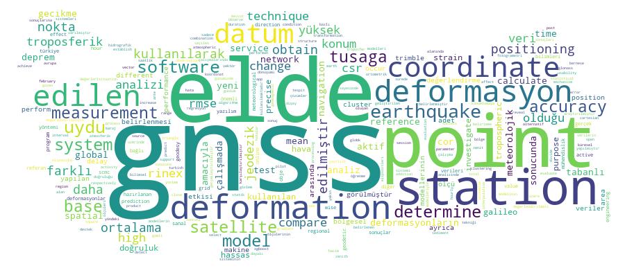
Competency Cloud